Running route along Singapore River
First thing that I had to mention was I did not take these photos during my run there. I was walking. To be exact, I walked from Raffles City via the underpass over to the Esplanade, then alongside the river towards the floating platform and then crossing the Helix Bridge towards the other side to The Shoppes at Marina Bay Sands.
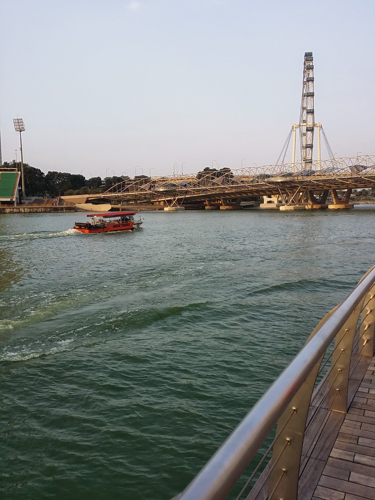
The picture above was taken from the Marina Bay Sands side of the river, overlooking the floating platform. The Helix Bridge is able to give everyone a good view of the Singapore River and the Singapore Flyer, but I doubt that you would miss the view of the Flyer since it is standing at a whooping 165 m. When an object is this tall, it's hard to miss.
The Helix Bridge, previously known as Double Helix Bridge is the longest pedestrian walkway in Singapore, with a length of 280 m. It was officially opened on 24 April 2010 and is the world's first curved bridge.
The Helix Bridge resembles the DNA structure, which too has a double helix structure. What is even more interesting are the road lights on the floor. The lights mainly shine out 4 letters - a, t, c and g. Why these 4 letters is because these are the first letters of the amino acids that can be found in the DNA structure.

Adenine (A) pairs with Thymine (T) and Cytosine (C) pairs with Guanine (G).
 |
| The Art Science Museum (right) and Marina Bay Sands (left). |

There are quite a number of runners running along the Singapore River. It is typically windy along the river during the evening and I feel is the best time and place for running. Not only is it windy, you can also take in the nice views that are lined along the river.
Running along the river and under the Helix Bridge, brings you towards Garden by the Bay. There are also designated running/walking paths and cycling paths on the road in the garden. I do hope that there are markings on the road that tells you how far you have ran (like those roads along the beaches) since there are so many people pumping these roads. It would have been really convenient for the runners.
Even if you are not running, it would also serve as a good place for an evening stroll. And if you are lucky, you might also spot some otters nearby. At least this was what the signs along the garden were trying to tell us, although I didn't spot any otters.
There are also plenty of benches that lines the roads so you do not have to worry about feeling tired halfway. Just grab a seat and enjoy the view.

Walking along the road eventually brings you past the two flower domes and towards Satay by the Bay, a convenient hawker centre for the hungry tummies after the run. Further down is the Marina Barrage, where you can make your way up to the rooftop to catch a view of the entire CBD area and the open sea.

The Marina Barrage rooftop 'field' serves as a good place for picnics and dates. And like I've mentioned that it's windy along this area, it's also a good place for flying kites. This is definitely a good place to end your run. (Going up to the rooftop is free by the way)
As I walked along the path, I felt that it was a fairly good distance to run, judging that I am not a very fit runner. But for those more experienced than I am, it is good to start your run near Fullerton Bay Hotel and work your way towards the Esplanade, then the floating platform before continuing the route I mentioned above, ending at Marina Barrage.
But one thing I've always wondered.. Do these runners bring a bottle along with them? Because as all of them pack light (basically just a handphone and earpiece), where do they put their other belongings? Did they bring them at all?
I want to try running along this route too but I'm wondering what do runners bring with them when running in areas that are generally not near to home?


Comments
Post a Comment